 Открыть торговый счет
With the advent of modern technology, it seemed that the whole world was accessible to us. With the help of devices, we can look anywhere in the world and even walk around a bit. However, not all so simple.
I collected a number of places, which for various reasons are hidden on the cards from the eyes of users. And at the end of you waiting for a curious bonus.
7. HAARP, Alaska, USA
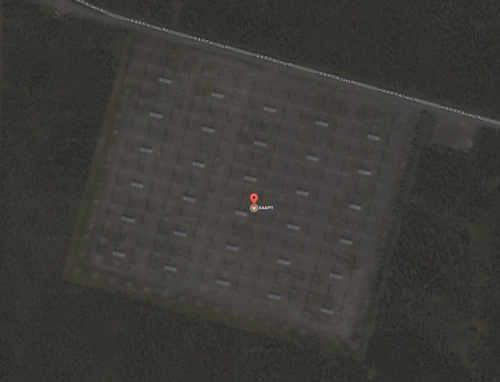
HAARP is an American program for studying the nature of the ionosphere and the development of anti-aircraft and anti-missile defense systems. One of the most controversial projects of the United States, which, due to the station's radiation of powerful electromagnetic radiation, conspiracy is accused of droughts, hurricanes and chronic fatigue syndrome.
Unsurprisingly, the object is hidden on Google Maps. In addition to the fact that the satellite shows a monotonous blurry structure, when you try to zoom in and look at the station, the screen becomes black.
6. Ghost Island in the Pacific Ocean
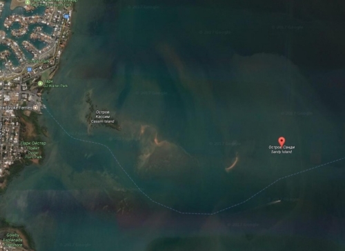
The sandy island of Sable (Sandy Island) is a rather unusual story. In the 1770s, Captain James Cook found it and put it on the cards. However, when it began to search for modern researchers, the island seemed to have disappeared. On Google Maps, it was displayed until November 26, 2012, and then was removed. Hence the emergence of an intriguing "failure" in the place of the allegedly existing island.
5. Warsaw, Poland
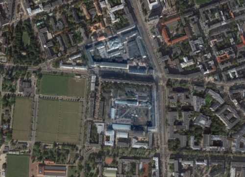
This area in the capital of Poland is strangely colored and rather blurred as it approaches.
If you look closely, the Military Garrison Prosecutor's Office, the Military Court and other buildings of similar purpose are located on the territory. Therefore, it is not surprising that on satellite maps they are a bit hidden.
4. NATO Headquarters in Brussels

The location of NATO headquarters in Brussels looks like a shot from the films about superagents.
Given the fact that there is a military base right next to it, it is not at all clear - either behind a sandy terrain some serious object is veiled, or the headquarters is in fact located underground.
3. Nuclear power plant in Marcool, France
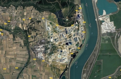
In this area in Marcool is a nuclear power plant, containing uranium and plutonium, and the base for the study of atomic weapons. Back in 2011, an explosion occurred on the site, because of which one of the employees died. And, in addition, the station has repeatedly been accused of negligence in the approach to nuclear installations.
Perhaps, half of this information is enough to have an excuse to hide this area on maps.
2. Mururoa Atoll, France
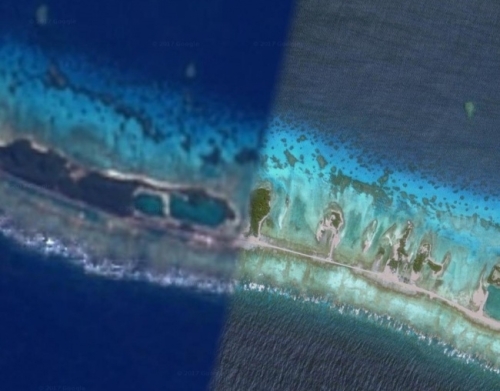
Among the French Polynesian islands scattered in the South Pacific, there is an atoll called Mururoa, which, it seems, can hide something.
Some parts of the island are visible, while others are really blurred. It is said that the island has a runway, dock and some buildings.
France conducted more than 170 nuclear weapons tests near Mururoa between 1966 and 1996 - perhaps this is the cause of this veiledness.
1. Noordwijk, South Holland
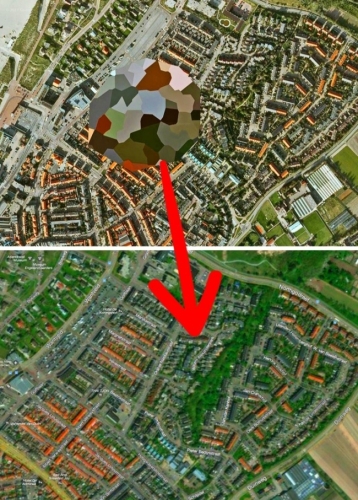
And perhaps the most mysterious phenomenon of Google Maps is the retouched place in the sleeping area of Noordwijk, hidden by Google, but quietly available on Bing Maps.
Maybe the grandmother of the director of Google just lives there?
Bonus: Kangtega, Nepal
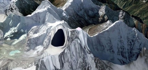
Since the moment when one of the users found a black dip in the place of the mountain peak in Nepal, disputes over its occurrence for a long time did not abate. There were versions of the presence of hidden military bases and even the headquarters of aliens in this place. After some time, the anomaly was eliminated, but until now it is impossible to say exactly whether it was a system error or in fact a mountain peak that something was hiding.